This Earth Week, learn how to become an environmental expert in your community!
In today’s digital world, online tools or web applications are a convenient way for public agencies like the EPA to share information about polluting industries and their potential harm to the environment. For communities, these tools may be particularly useful to combat environmental injustice. By mapping important information about facilities, pollutants, water sources and other publicly available resources, users can gain the knowledge they need to face any challenges in their area. But these applications can also be difficult for the general public to find and use, especially for community members who are simply concerned with their health and their neighborhood’s well-being.
CWFNC’s “Community Tools” project aims to fill this gap by making information on these applications more accessible to everyday folks who want to investigate their own areas. Currently, there are a total of eight tools we’ve identified, built by both national and local agencies, with environmental and community data that may be helpful to community members. Our goal is to create a fact sheet and video tutorial for each tool, along with captions in English and Spanish. You can stay up-to-date with this project by checking out the “Tools” webpage on CWFNC.org, which contains links to a selection of online tools, preexisting instructions and guides, and our own resources that we’ve developed.
Check out CWFNC’s Community Tools Page!
SWAPInfo 2.0 Tool
The Source Water Assessment Program (SWAP) mapping tool contains information about North Carolina’s public drinking water, including surface water sources, groundwater sources, and wellhead protection areas. This tool, developed by NC’s Department of Environmental Quality, helps users visualize SWAP data alongside other environmental hazards, known as “Potential Contaminant Sources” (PCS).
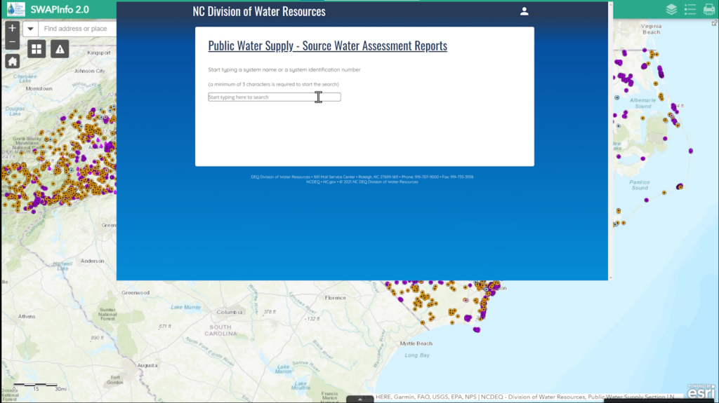
Animal operations, toxic waste sites, landfills and more are included under the PCS layer. You can view the information on the map by selecting the different layers related to drinking water and potential contamination sources. If you want to see all the PCS in the state or your area, simply click on “All PCS Combined.” Interested in information on a specific place? You can use the search bar to identify street addresses or public water systems. Need to make a list of concerns in your area? The proximity search feature can filter SWAP and PCS data by location to create several spreadsheets of relevant information that you can then download.
There are several additional resources available to learn more about NC’s drinking water sources. The links available on the SWAP application jump to detailed reports on water sources, background information on the tool’s data, an instruction guide, and contacts for NC Source Water programs. And on CWFNC.org, we have a fact sheet for the SWAP tool, as well as a tutorial video that is under development and coming soon. Be sure to check out our website for any updates!